 terravel
Terravel · Places · South America
Peru · South America
Sacred Valley

What is Sacred Valley, and where is it?
The Sacred Valley, or Urubamba Valley, lies in the Peruvian highlands north of Cusco. This fertile river valley, stretching from Pisac to Machu Picchu across 100 kilometers, was gradually incorporated into the Inca Empire between 1000 and 1400. It became the empire's heartland for maize production and remains marked by ancient terraces and stone architecture.
Location and River Geography
The Sacred Valley runs west to east through the Peruvian Andes, north of Cusco in the present-day Cusco region. The Urubamba River—also called the Vilcanota, Willkanuta, or Willkamayu in Quechua, meaning 'sacred river'—carves through the valley floor, which averages about one kilometer wide. Elevations along the river range from 3,000 meters at Pisac to 2,050 meters below Machu Picchu, a distance of roughly 100 kilometers.
Mountains rise steeply on both sides of the river, particularly to the north where Sahuasiray reaches 5,818 meters and Veronica rises to 5,893 meters. The Urubamba is fed by tributaries descending through adjoining valleys and gorges. Agricultural terraces, called andenes, expand the cultivatable area beyond the narrow valley floor. This geography—lower elevation than surrounding highlands, warmer climate, and river irrigation—made the valley ideal for growing maize, the crop that would sustain an empire.
Climate and Water Management
The Sacred Valley experiences a highland climate with distinct wet and dry seasons. Precipitation concentrates between October and April, totaling 527 millimeters annually. Monthly average temperatures range from 15.4°C in November to 12.2°C in July. This seasonal pattern created challenges for agriculture, particularly during dry months when water became scarce.
The Incas responded by building extensive irrigation works throughout the valley to manage water deficiency and seasonality. These systems, combined with the river's flow and tributary streams, allowed year-round cultivation. The engineering infrastructure remains largely intact, demonstrating how the Incas adapted their landscape to support large-scale food production in a region where precipitation alone could not sustain intensive farming.
Maize Production and Imperial Power
The Sacred Valley was the most important maize-growing region in the Inca heartland. Maize held ceremonial and practical significance—the Incas fermented it into chicha, a drink consumed in vast quantities at religious festivals and ceremonial feasts. Control of maize production meant control of the rituals that bound the empire together. The valley's lower elevation and warmer climate made it one of the few places in the high Andes where maize could be reliably grown.
Large-scale production was apparently facilitated by crop varieties bred at Moray, a site nearby that may have functioned as a governmental crop laboratory or seedling nursery. The valley also provided access to tropical lowland products—coca leaf and chile peppers—that were imported to Cusco. This combination of local production and trade connections made the Sacred Valley economically vital to the empire's expansion and maintenance.
Agricultural Terraces as Inca Legacy
The most visible and widespread signs of Inca civilization in the Sacred Valley are the agricultural terraces carved into hillsides flanking the valley floor. These andenes represent an engineering solution to steep terrain, transforming mountainsides into productive land. The terraces still hold their shape after centuries, their stone walls enduring without mortar. Walking through the valley today, a visitor encounters these structures as the primary physical evidence of how the Incas reorganized the landscape.
The terraces reflect Inca philosophy about architecture and order. Rather than building artificial mountains like some Pre-Columbian cultures, the Incas emphasized natural topography, working with the land's existing forms. This approach extended to other structures in the valley, such as the Sacred Rock, which draws attention to the horizon of the surrounding mountains. The terraces remain functional in many areas, still used for agriculture, making them living monuments to Inca engineering and land management.
Gradual Integration and Spanish Conquest
The Sacred Valley was incorporated into the Inca Empire gradually over four centuries, from 1000 to 1400, rather than conquered in a single campaign. Earlier civilizations had recognized the valley's agricultural potential: the Chanapata civilization used the area starting around 800 BCE, the Qotacalla civilization lived there from 500 to 900 CE, and the Killke civilization flourished from 900 until absorption into the Inca Empire around 1420. This gradual integration allowed local communities to evolve within Inca culture rather than experience sudden conquest.
By the 1400s, the valley had become an area of royal estates and country homes. Emperors including Yawar Waqaq, Viracocha Inca, Pachacuti, and Huayna Capac each established estates in the valley. Most archaeologists believe Machu Picchu was built as an estate for Pachacuti. The Inca ruled the Sacred Valley for little more than 100 years before Spanish arrival. In 1537, Inca Emperor Manco Inca Yupanqui won the Battle of Ollantaytambo against Spanish forces led by Hernando Pizarro, but soon withdrew, and the valley came under Spanish colonial control.
Where is Sacred Valley?
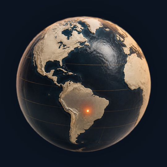
Sacred Valley is in Peru, South America, at 13.33°S, 72.08°W. The closest places in the Terravel atlas are Machu Picchu (53 km), Colca Canyon (252 km) and Titicaca (406 km).
Photos of Sacred Valley

Photo: Chris Jackson · CC BY 2.0

Photo: Photographer: Rubyk · CC BY-SA 2.5

Photo: Charles Gadbois · CC BY 3.0
Sacred Valley at a glance
Questions about Sacred Valley
What civilizations lived in the Sacred Valley before the Incas?
The Chanapata civilization first used the area around 800 BCE for agriculture. The Qotacalla civilization lived there from 500 to 900 CE, followed by the Killke civilization from 900 until approximately 1420, when it was absorbed into the Inca Empire. Each civilization recognized the valley's rich soil and favorable climate for farming.
How did the Incas divide land in the Sacred Valley?
The Inca customarily divided conquered lands into three roughly equal parts: one for the emperor, one for the religious establishment, and one for farming communities. In the 1400s, the Sacred Valley became predominantly royal estates. Once an emperor created an estate, his descendants continued to own it after his death, establishing a system of inherited imperial properties.
What is chicha and why was it important to the Incas?
Chicha is a fermented maize drink that held ceremonial and religious significance. The Incas consumed it in large quantities at religious festivals and ceremonial feasts. During warfare, they reportedly transformed enemy skulls into drinking vessels for chicha, symbolizing the transformation from disorder of war to order of empire. Maize production in the Sacred Valley supported this ritual practice.
How did the Incas manage water in the Sacred Valley?
The Incas built extensive irrigation works to counter seasonal precipitation and water deficiency. Precipitation concentrates between October and April, totaling about 527 millimeters annually. The irrigation systems, combined with the Urubamba River and tributary streams, allowed year-round cultivation despite the dry season, enabling intensive agricultural production.
What happened to the Sacred Valley after Spanish arrival?
In 1537, Inca Emperor Manco Inca Yupanqui defeated Spanish forces at the Battle of Ollantaytambo, but soon withdrew from the valley. The Sacred Valley then came under Spanish colonial control. The Spanish referred to it as the 'Valley of Yucay' in colonial documents, though the Incas had known it as sacred.
Sources and further reading
This article was written from the reference material below, retrieved and reviewed for source alignment on September 13, 2026. Use official local sources for changing access or travel information.
About this page. Terravel combines its curated place catalog with credited photography and geographic reference data. Practical travel details can change; use the linked destination guide and official local sources when planning a trip. Send a correction.
Test yourself
Which South American valley features Inca agricultural terraces still visible on mountainsides today?
The Sacred Valley, Peru contains ancient Inca terraces carved into the Peruvian highlands that remain intact and visible—a distinctive feature directly supported by the facts about how the Incas transformed the vertical landscape into agricultural abundance.
Can you place today's?
Sacred Valley is one of 266 places in Terravel. A new one every morning.
Go beyond the familiar in South America
Start with a place you know, then follow the map toward somewhere less expected.


