 terravel
Terravel · Places · South America
Brazil · South America
Iguaçu National Park

What is Iguaçu National Park, and where is it?
Iguaçu National Park is a 185,262-hectare protected rainforest in Paraná State, Brazil, centered on the Iguazu River and its massive waterfalls. The park's 300 kilometers of waterways form the official boundary between Brazil and Argentina, making the landscape itself an international border.
Location in Paraná and the Triple Border Region
Iguaçu National Park occupies the westernmost region of Paraná State, 17 kilometers from the city of Foz do Iguaçu. The park stretches across ten municipalities: Foz do Iguaçu, Medianeira, Matelândia, Céu Azul, São Miguel do Iguaçu, Santa Terezinha de Itaipu, Santa Tereza do Oeste, Capitão Leônidas Marque, Capanema, and Serranópolis. Its 420-kilometer length follows the Iguazu River basin, with 300 kilometers of that distance formed by water and forest edges that serve as the official demarcation line between Brazil and Argentina.
The Iguazu River originates near the Serra do Mar mountain range close to Curitiba and flows 18 kilometers through Paraná before reaching the falls. Eighteen kilometers downriver from the falls, the Iguazu meets the Paraná River, creating a triple border point where Brazil, Argentina, and Paraguay converge. This geographic convergence makes the park part of a larger Upper Paraná ecoregion that spans three nations, with conservation efforts extending across borders through ecological corridors and protected areas.
The Iguazu Falls and Water-Formed Landscape
The Iguazu Falls form a semicircular cascade approximately 2,700 meters wide, with water dropping 72 meters. The number of individual waterfalls varies between 150 and 300 depending on the river's flow rate. The falls occupy roughly 50 square kilometers of the river's length and generate massive clouds of spray that sustain lush vegetation growth across the surrounding forest. This water-dominated landscape defines the park's physical character and creates the natural boundary between nations.
Beyond the main falls, the park contains other water features including the Poço Preto (Black Well) and the Macuco Waterfall. The Iguazu River system itself functions as both a geographic and ecological feature, carving through the landscape and supporting the rainforest ecosystem. The spray from the falls creates microclimates that influence vegetation patterns throughout the park's western sections.
International Conservation and UNESCO Recognition
Iguaçu National Park was established by federal decree on January 10, 1939, making it one of Brazil's earliest protected areas. The Brazilian and Argentine portions together encompass approximately 260,000 hectares of shared wilderness. On November 17, 1986, the park received UNESCO World Heritage Site designation during a conference in Paris, recognizing it as Natural Heritage of Humanity. The park is managed by the Chico Mendes Institute for Biodiversity Conservation (ICMBio), a federal agency responsible for stewarding the protected ecosystem.
The park's creation followed a conservation campaign initiated by engineer André Rebouças in 1876, decades before many other national parks were established. Rebouças envisioned preserving the falls and surrounding forest in their pristine state for future generations. The park became the first in Brazil to receive a comprehensive Management Plan, reflecting its ecological significance as the most important protected area in the Prata Basin and a haven for rare genetic assets of plant and animal species.
Rare Species and Rainforest Biodiversity
The park shelters many rare and endangered species of flora and fauna, including the giant otter and the giant anteater. The 185,262-hectare expanse of pristine rainforest provides habitat for species found nowhere else, making it a significant genetic reservoir for South American biodiversity. The lush vegetation sustained by waterfall spray creates distinct ecological zones within the park, each supporting different plant and animal communities adapted to varying moisture and light conditions.
The park's role as a biodiversity refuge extends beyond its borders through the Santa Maria Ecological Corridor, which connects Iguaçu National Park to the protected margins of Lake Itaipu and onward to Ilha Grande National Park. A proposed Trinational Biodiversity Corridor aims to link conservation units across Brazil, Paraguay, and Argentina in the Upper Paraná ecoregion, allowing species movement and genetic exchange across the region's protected areas.
Early Preservation Vision and Modern Visitation
André Rebouças's 1876 proposal for the park articulated a vision of preservation that encompassed ecological and scenic values. He sought to protect the falls and forest as they had been "created by God," preserving everything "from the beautiful to the sublime, from the picturesque to the awesome" and the "unmatched flora" of the region. This early conservation philosophy, predating Yellowstone's establishment by four years, positioned Iguaçu as a pioneering effort in environmental protection and scientific research.
Today, the park receives substantial visitation, with 1,550,700 visitors recorded in 2014. The area open to visitors accounts for approximately 0.3 percent of the park's total area, concentrating tourism in specific zones while preserving the vast majority as wilderness. Facilities include a Visitors Center and attractions such as the Santos Dumont Statue, a tribute to aviation pioneer Alberto Santos-Dumont, who contributed to efforts establishing the falls as a national park. The park supports environmental education, scientific research, and ecological tourism alongside recreation in natural surroundings.
Where is Iguaçu National Park?
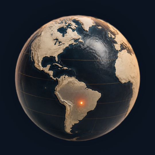
Iguaçu National Park is in Brazil, South America, at 25.68°S, 54.43°W. The closest places in the Terravel atlas are Ipanema District (1,176 km), Atacama Desert (1,497 km) and Titicaca (1,894 km).
Photos of Iguaçu National Park

Photo: Bernardo Moraes · CC BY-SA 4.0

Photo: TontiTonti · CC BY-SA 3.0

Photo: Bernardo Moraes · CC BY-SA 4.0
Iguaçu National Park at a glance
Questions about Iguaçu National Park
How does the Iguazu River function as an international border?
The Iguazu River and its 300 kilometers of natural waterways form the official boundary between Brazil and Argentina. The waterfalls themselves, spanning 2,700 meters, are demarcation lines rather than obstacles to border definition. The river originates near Curitiba and flows 18 kilometers through Paraná before reaching the falls, then continues 18 kilometers more to meet the Paraná River at the triple border with Paraguay.
What species are protected in the park?
The park shelters rare and endangered flora and fauna, including giant otters and giant anteaters. The 185,262-hectare rainforest serves as a significant genetic reservoir for South American biodiversity. Specific species lists are not detailed in available sources, but the park's designation as a UNESCO World Heritage Site reflects its importance for preserving unique plant and animal communities found in the Upper Paraná ecoregion.
When was the park established and why?
Iguaçu National Park was created by federal decree on January 10, 1939, following a conservation campaign initiated by engineer André Rebouças in 1876. The park was established to preserve the falls and surrounding rainforest in their pristine state for future generations and to enable scientific research, environmental education, and ecological tourism while protecting the region's ecological and scenic values.
How much of the park is accessible to visitors?
Approximately 0.3 percent of the park's 185,262 hectares is open to visitation, where concession areas operated by Cataratas do Iguaçú S/A are located. This concentrated visitation zone preserves the vast majority of the park as wilderness. The park received 1,550,700 visitors in 2014, primarily viewing the Iguazu Falls and other attractions like the Poço Preto and Macuco Waterfall.
What is the Trinational Biodiversity Corridor?
The proposed Trinational Biodiversity Corridor aims to connect conservation units across Brazil, Paraguay, and Argentina in the Upper Paraná ecoregion. The Santa Maria Ecological Corridor already links Iguaçu National Park to Lake Itaipu's protected margins and Ilha Grande National Park, facilitating species movement and genetic exchange between protected areas across the three nations.
Sources and further reading
This article was written from the reference material below, retrieved and reviewed for source alignment on September 13, 2026. Use official local sources for changing access or travel information.
About this page. Terravel combines its curated place catalog with credited photography and geographic reference data. Practical travel details can change; use the linked destination guide and official local sources when planning a trip. Send a correction.
Test yourself
Which South American park's waterfalls form the official border between two nations?
Iguaçu National Park's 300 kilometers of natural waterways serve as the demarcation line between Brazil and Argentina, making the waterfalls themselves international boundaries.
Can you place today's?
Iguaçu National Park is one of 266 places in Terravel. A new one every morning.


