 terravel
Terravel · Places · South America
Venezuela · South America
La Guajira Desert

What is La Guajira Desert, and where is it?
La Guajira Desert is South America's largest desert north of the equator, spanning the northernmost peninsula shared by Colombia and Venezuela. Located roughly 1,100 kilometers north of Bogotá, it stretches across the La Guajira Peninsula where the Wayuu people have adapted to both arid terrain and Caribbean waters.
Location at South America's Northern Edge
La Guajira Desert occupies the northernmost tip of South America, extending approximately 1,100 kilometers north of Bogotá. The peninsula it covers straddles two nations: most territory falls within Colombia's La Guajira Department, while a smaller portion lies in Venezuela's Zulia state. This geographic position places the desert at the continent's northern frontier, where land meets the Caribbean Sea.
The peninsula's location creates a unique meeting point between terrestrial and marine environments. The desert's edge transitions directly to Caribbean waters, eliminating any gradual buffer zone. This stark adjacency defines the landscape and shapes how inhabitants relate to both ecosystems. The coordinates place the region at approximately 12.07°N latitude and 71.60°W longitude.
Xeric Scrubland and Macuira's Tropical Anomaly
The peninsula is predominantly covered by xeric scrubland—vegetation adapted to extreme aridity. This sparse plant community supports a large variety of flora and fauna despite the harsh conditions. The National Natural Park of Macuira, established in 1977, represents a striking exception to the surrounding desert. This tropical oasis occupies 25,000 hectares within the La Guajira's only mountain chain, ranging from sea level to 450 meters in elevation.
Macuira maintains a warm climate averaging around 27°C (81°F), creating conditions that sustain tropical vegetation in an otherwise arid region. The park's existence demonstrates how altitude and localized moisture patterns can produce ecological islands within desert landscapes. The contrast between the park's lush environment and the surrounding xeric scrubland makes Macuira a notable geographic feature within the broader desert system.
Coal Mining and Resource Extraction
Beneath the desert's surface lie immense coal reserves that have shaped economic activity in the region. These deposits are exploited in a zone known as El Cerrejón, which represents significant resource extraction infrastructure. The presence of these reserves has influenced settlement patterns and development across the peninsula, creating an economic dimension that overlays the traditional land use by indigenous populations.
The coal mining operations exist alongside the traditional economies of herding and pearl diving practiced by the Wayuu people. This coexistence of industrial extraction and indigenous subsistence creates a complex landscape where modern resource development intersects with centuries-old cultural practices. The scale of coal reserves indicates their importance to regional and national economies.
The Wayuu: Desert Herders and Deep-Sea Divers
The Wayuu people are the primary indigenous inhabitants of La Guajira Desert, having adapted to its extremes across generations. Most Wayuu are herders who manage livestock across the arid terrain, a practice that requires intimate knowledge of water sources and seasonal patterns. This herding tradition represents a long-established relationship with the desert environment, developed through centuries of inhabitation.
What distinguishes the Wayuu is their dual mastery of two vastly different ecosystems. Beyond herding, they are renowned deep-sea divers who venture into the Caribbean's depths to harvest pearls. This extraordinary skill set—moving seamlessly from desert to ocean—defines their unique cultural and economic identity. The ability to thrive in both environments reflects adaptive strategies refined over generations, creating a relationship with the peninsula that encompasses both its terrestrial and marine dimensions.
Desert Ecology and Biodiversity
Despite its arid conditions, La Guajira Desert supports a large variety of flora and fauna adapted to xeric environments. The scrubland vegetation represents specialized plant communities that have evolved to survive with minimal water. These plants provide food and shelter for animals that have similarly adapted to desert life, creating an interconnected ecological system sustained by extreme conditions.
The National Natural Park of Macuira introduces a secondary ecological zone within the desert. The park's tropical oasis supports different species assemblages than the surrounding scrubland, creating ecological diversity across the peninsula. This variation in habitat types—from xeric scrubland to tropical mountain forest—demonstrates how geography and altitude create distinct ecological zones within a single desert region.
Where is La Guajira Desert?
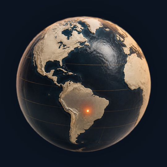
La Guajira Desert is in Venezuela, South America, at 12.07°N, 71.60°W. The closest places in the Terravel atlas are Orinoco River (1,414 km), Viñales Valley (1,739 km) and Cordillera Blanca (2,460 km).
La Guajira Desert at a glance
Questions about La Guajira Desert
How large is La Guajira Desert?
La Guajira Desert is South America's largest desert north of the equator. It spans the La Guajira Peninsula, which extends approximately 1,100 kilometers north of Bogotá. Most of the region lies within Colombia's La Guajira Department, with a smaller portion in Venezuela's Zulia state.
What is the National Natural Park of Macuira?
Macuira is a tropical oasis established as a national park in 1977, covering 25,000 hectares within the La Guajira's only mountain chain. It ranges from sea level to 450 meters elevation and maintains a warm climate averaging 27°C, creating a lush environment that contrasts sharply with the surrounding desert.
What resources are extracted from La Guajira Desert?
Immense coal reserves lie beneath the desert's surface and are exploited in a zone known as El Cerrejón. This mining operation represents significant resource extraction infrastructure within the region, coexisting with traditional indigenous economies.
How do the Wayuu people use the desert and sea?
The Wayuu are primarily herders who manage livestock across the arid terrain. They also work as master deep-sea divers, venturing into the Caribbean to harvest pearls. This dual economy allows them to exploit resources from both the desert and ocean ecosystems.
What vegetation grows in La Guajira Desert?
The peninsula is predominantly covered by xeric scrubland—vegetation adapted to extreme aridity. This sparse plant community supports a large variety of flora and fauna despite harsh conditions. Macuira's tropical oasis represents an exception, with lush vegetation sustained by altitude and localized moisture patterns.
Sources and further reading
This article was written from the reference material below, retrieved and reviewed for source alignment on September 13, 2026. Use official local sources for changing access or travel information.
About this page. Terravel combines its curated place catalog with credited photography and geographic reference data. Practical travel details can change; use the linked destination guide and official local sources when planning a trip. Send a correction.
Test yourself
Which desert's indigenous people are known for herding livestock on land, then diving deep into the Caribbean to harvest pearls?
La Guajira Desert is home to the Wayuu people, who uniquely combine pastoral herding across the arid peninsula with skilled deep-sea pearl diving in the adjacent Caribbean waters.
Can you place today's?
La Guajira Desert is one of 266 places in Terravel. A new one every morning.


